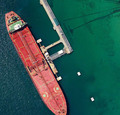
Aerial Imagery Perth
Company Introduction
Uncompromising sensor quality means we capture colour images, with true colour depth and sharpness unparalleled in the aerial survey Perth industry. When the finer details like sharpness and colour matter then we have the product. Remember, all images are not created equal. Colour images can be used for most applications such as making maps, using in a Geographic Information System (GIS) for overlaying vector layers like contours, boundaries, infrastructure, tenements etc.
View All »


